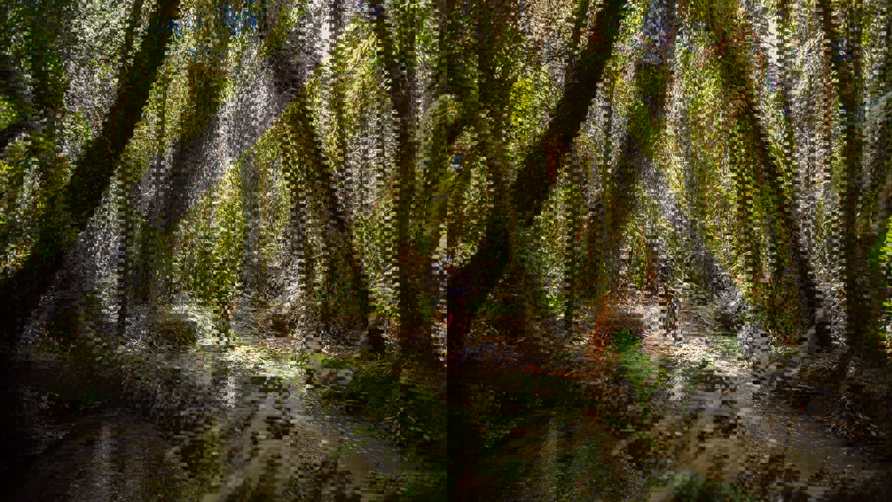



The 42 Traverse is a challenging backcountry adventure through the native forest and rugged landscapes of the Tongariro Forest Conservation Area. Following an old logging road through what was once known as State Forest 42, the 46 km route offers remote terrain, the impressive Canyon Valley and views back towards the volcanoes of Tongariro National Park.
The track is popular with mountain bikers, trampers, horse riders, hunters and fishers, as well as quad bikes, trail bikes and 4WD vehicles where access allows.
This is a remote and technically challenging route, best suited to experienced, well-equipped adventurers. Slips, fallen trees, rough terrain and changing track conditions are common, so make sure you’re prepared before setting out.
Kapoors Road to Ohinetonga Road
The 42 Traverse can be travelled in either direction, although walkers and mountain bikers will generally find it easier travelling from Kapoors Road to Ohinetonga Road, with more downhill riding or walking in this direction.
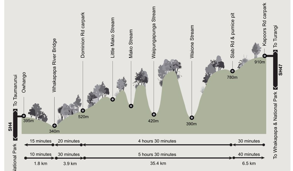
Starting at the end of Kapoors Road, off SH47, the route heads north through Tongariro Forest. There are numerous intersecting tracks and old logging roads along the way, so pay close attention at junctions and carry reliable navigation tools, including a map, GPS and compass.
The track descends to Waione Stream before climbing out of the valley towards the bypass around the major landslide. From there, the 42 Traverse continues past Mako Stream before reaching Ohinetonga Road, an unsealed road leading into Ōwhango.
There are several unbridged stream crossings along the route. Water levels can rise quickly following rain, making crossings unsafe. Always assess conditions carefully and, if in doubt, stay out.
The 42 Traverse also forms part of Te Araroa between the Ohinetonga Road end and Waione Stream. Near Waione Stream, Te Araroa walkers leave the 42 Traverse and continue along a separate tramping track.
Landslide bypass
A large landslide currently affects the 42 Traverse. Do not attempt to cross the landslide, as the area may still be unstable.
View the 42 Traverse bypass track map (PDF)
- Walkers and mountain bikers can use a bypass around the landslide.
- Signage on the bypass is limited, so GPS navigation is strongly recommended.
- Mountain bikers should dismount through the bypass section as the terrain is steep and slippery.
- There is no bypass for 4WD vehicles, quad bikes or motorbikes, meaning these vehicles cannot complete the full 42 Traverse.
- The bypass is not recommended for horse riders, who should return the same way they entered.
Mountain biking
For experienced riders, the 42 Traverse is a proper backcountry challenge.
The route travels through a remote area with steep climbs, narrow sections, drop-offs, sharp corners and technical obstacles. There is no easy exit once you are committed to the route, so riders need good fitness, appropriate equipment and strong mountain biking experience.
Be prepared to walk your bike through some sections and potentially carry it where conditions require.
4WD access
The 42 Traverse is open to 4WD vehicles during summer, from 1 December to 30 April. Vehicles are not permitted on the route from 1 May to 30 November and must remain on the designated 42 Traverse route.
This is a rough and remote 4WD track. Drivers should have strong 4WD experience, carry recovery equipment and be prepared to be self-sufficient.
Following rain, stream levels can rise quickly. Always check waterways carefully before attempting a crossing.
Important: Due to the large landslide, there is currently no through-route for 4WD vehicles, quad bikes or motorbikes.
Seasonal restrictions
4WD vehicles are not permitted on the 42 Traverse from 1 May to 30 November.
Know before you go
The 42 Traverse is a remote backcountry route and conditions can change quickly. Before heading out:
- Check current track and weather conditions.
- Carry a map, GPS and compass and know how to use them.
- Take enough food, water, warm clothing and emergency supplies.
- Be prepared for slips, fallen trees and rough or technical terrain.
- Take particular care at unbridged stream crossings, especially after rainfall.
- Allow plenty of time to complete your trip.
- Tell someone where you are going and when you expect to return.
For the latest track conditions, access information and safety advice, check with the Department of Conservation before setting out.